Boundary Survey Explained for Property Owners
A boundary survey for property owners is not optional. It is the first step that protects your investment before a single shovel hits the ground. Skip it, and you could be building on land you do not legally own.
Nashville’s rapid growth has made property disputes more common than ever. Middle Tennessee added over 100 new residents per day between 2020 and 2023, according to the U.S. Census Bureau. More people means more development. More development means more boundary conflicts.
What Is a Boundary Survey?
A boundary survey is a legal document. A licensed land surveyor locates and maps the exact edges of a parcel of land. It shows where your property starts and where it ends.
This is different from a topographic survey, which measures elevation. It is also different from an ALTA survey, which is more detailed and often required by lenders.
A boundary survey answers one question: Where exactly is my property line?
What Does a Boundary Survey Include?
- The legal description of the parcel
- The location of all property corners, marked with iron pins or monuments
- Encroachments from neighboring properties
- Easements that cross or border the land
- A plat or map drawn to scale
- The surveyor’s stamp and signature
In Tennessee, only a Professional Land Surveyor (PLS) licensed by the Tennessee Board of Licensure for Professional Engineers and Land Surveyors can legally perform and certify a boundary survey.
Why Developers Need One Before They Build
Metro Nashville and Davidson County require a licensed survey before issuing many types of development permits. That includes subdivision plats, rezoning applications, and some commercial building permits.
Beyond permits, here is what a boundary survey protects you from:
- Encroachment disputes. A fence, driveway, or structure built over a property line can result in costly litigation or forced removal.
- Title issues. Title insurance companies typically require a boundary survey before issuing a policy on new construction.
- Setback violations. Metro Nashville zoning codes require specific setbacks from property lines. Without a survey, you are guessing.
- Easement surprises. Utility easements or access easements can limit where you can build, even on land you own.
How the Boundary Survey Process Works
Step 1: Hire a Licensed Surveyor
Look for a PLS registered with the Tennessee Board of Licensure. Ask for experience with Nashville Metro projects specifically. Local surveyors know Davidson County’s older plat records, which can be inconsistent or poorly indexed.
Step 2: Provide the Legal Description
Your deed includes a legal description of the property. Give this to your surveyor along with any previous surveys, title reports, or plat maps you have.
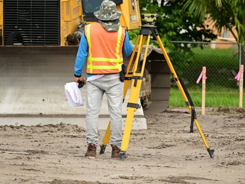
Step 3: Field Work
The surveyor’s crew visits the site. They locate existing monuments, measure distances, and set new iron pins at the corners if needed.
Step 4: Research
The surveyor pulls deed records, historical plats, and adjoining property descriptions from the Davidson County Register of Deeds. This step can take longer for older properties with complex ownership histories.
Step 5: Draft and Certify the Plat
The surveyor produces a scaled drawing of the parcel with all findings noted. They sign and stamp it. This document is now legally valid in Tennessee.
How Long Does It Take?
Most standard boundary surveys take 2 to 6 weeks from order to delivery. Complex projects or properties with title issues can take longer. Plan for this in your development timeline.
How Much Does a Boundary Survey Cost?
Costs vary based on parcel size, complexity, and location. A typical residential boundary survey runs between $500 and $1,500. Commercial or larger parcels can cost $2,000 to $5,000 or more. Always get a written quote before signing a contract.
Common Boundary Survey Issues Developers Run Into
Gaps and Overlaps in Old Plats
Many older neighborhoods were platted before modern GPS equipment. Older surveys sometimes leave gaps or overlaps between adjacent parcels. A licensed surveyor will flag these and help you resolve them before they become legal problems.
Easements That Restrict Development
Nashville has a dense network of utility easements, especially in areas with older infrastructure. A boundary survey will show these easements on the plat. Some easements prohibit permanent structures. Check this before you design your site plan.
Adverse Possession Claims
Tennessee law allows a party to claim ownership of land they have openly and continuously occupied for seven or more years. If a neighbor has been mowing or using part of your parcel, you need to address it before development. A surveyor documents the situation. An attorney handles the legal resolution.
Frequently Asked Questions
Do I need a boundary survey before buying land?
Yes. A boundary survey before closing protects you from buying a parcel with encroachments, easements, or title gaps. Most commercial lenders require one before funding a development loan.
What is the difference between a boundary survey and an ALTA survey?
A boundary survey identifies property lines. An ALTA/NSPS survey is more comprehensive. It includes easements, improvements, zoning information, and other details required by title companies and lenders on commercial deals. ALTA surveys follow national standards set by the American Land Title Association.
Can I use an old survey for my development project?
Sometimes. If the previous survey was done by a licensed PLS and is recent, some agencies will accept it. But if conditions have changed, if the survey is more than five years old, or if a lender requires a current survey, you will need a new one.
What happens if my neighbor disputes the boundary line?
A certified survey is evidence in court. If a neighbor disagrees with the findings, the dispute typically involves a review of deed records and historical surveys. In serious cases, a real estate attorney handles the resolution. The survey is your starting point, not the end of the conversation.
Who regulates land surveyors in Tennessee?
The Tennessee Board of Licensure for Professional Engineers and Land Surveyors oversees all PLS licensees. You can verify a surveyor’s license status at their official state website. Always confirm licensure before hiring.