
What Is Land Surveying and Why Does It Matter?
Land surveying is the science of measuring and mapping land. It tells you exactly where a property begins and ends, how the land is shaped, and what legal rights or restrictions apply to it. For anyone who owns, buys, or builds on property, understanding what land surveying is and when you need it can save you from costly mistakes down the road.
What Does a Land Surveyor Actually Do?
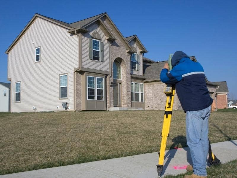
A land surveyor is a licensed professional who collects precise measurements of land using GPS equipment, robotic total stations, and historical property records. They analyze that data and produce legal documents that describe a property in detail.
Surveyors work from two sources. The first is field work, where they physically visit the site, locate existing markers, take measurements, and set new boundary pins. The second is records research, where they review deeds, historical plats, and public records to understand a property’s legal history.
The result is a certified survey document that can be used in real estate transactions, permitting, construction planning, and legal disputes.
Why Land Surveying Matters for Property Owners
Property ownership comes with legal responsibilities, and most of them depend on knowing exactly what you own. A land survey gives you that information in a legally recognized format.
Without one, you are relying on guesswork. Fences get built in the wrong place. Structures end up crossing property lines. Buyers close on properties with easements nobody knew about. These are not rare situations. They are common, and they are expensive to fix.
Nashville has grown rapidly over the past decade. That growth has pushed development into older neighborhoods where property records are sometimes incomplete or outdated. In those areas, a fresh survey is often the only reliable way to confirm what is actually on the ground versus what was recorded years ago.
What Are the Main Types of Land Surveys?
Land surveying covers several different types of work, each serving a specific purpose.
- Boundary surveys locate and map the legal edges of a parcel. They confirm where your property lines are and place physical markers at the corners.
- Topographic surveys record the shape of the land, including slopes, drainage features, trees, and structures. Engineers and architects use these before designing anything on a site.
- ALTA surveys are a more detailed version of a boundary survey used in commercial real estate. They include easements, improvements, access points, and other details required by lenders and title companies.
- Lot surveys are simpler surveys used when buying or refinancing a home in a recorded subdivision.
- Elevation certificates document a structure’s elevation relative to the base flood elevation on FEMA maps. These are required for flood insurance in many areas.
Each type serves a different need. The right one depends on what you are trying to accomplish.
When Do You Need a Land Survey?
There is no single answer, because it depends on your situation. That said, here are the most common times when a survey becomes necessary.
You are buying undeveloped land or a property outside a recorded subdivision. You are applying for a construction permit in Davidson County or a surrounding municipality. You have a dispute with a neighbor over where your property line falls. Your lender is requiring a survey as a condition of financing. You are planning to add a structure, fence, or addition and need to confirm setback requirements first.
In Tennessee, only a licensed Professional Land Surveyor (PLS) can legally certify a survey. Licensure is overseen by the Tennessee Board of Licensure for Professional Engineers and Land Surveyors under Tennessee Code Annotated, Title 62, Chapter 18. Before hiring anyone, confirm their license is active through the board’s official records.
How Accurate Is a Modern Land Survey?
Modern surveying equipment is precise to within fractions of an inch. GPS receivers used by professional surveyors are far more accurate than consumer-grade devices. Combined with robotic total stations that measure angles and distances electronically, today’s surveys are detailed and reliable.
That said, accuracy also depends on the quality of historical records. Older properties in Nashville, particularly those platted before the 1980s, sometimes have gaps or inconsistencies in the deed descriptions. A skilled surveyor will flag these and document them clearly in the final survey plat.
How Much Does a Land Survey Cos?
Survey costs depend on the type of survey, the size of the property, and how complex the terrain or title history is. A standard residential lot survey generally runs between $500 and $1,500. A boundary survey for a larger or more complex parcel can range from $1,500 to $3,500. ALTA surveys for commercial properties typically start around $2,000 and go up from there based on scope.
Getting a written quote before work begins is always a good idea. Costs can vary between firms, and a clear agreement upfront avoids surprises later.
Frequently Asked Questions
What is the difference between a land survey and a property appraisal?
A land survey measures the physical boundaries and features of a property. An appraisal estimates its market value. They serve entirely different purposes and are performed by different types of licensed professionals.
Does Tennessee require a survey before selling a property?
Tennessee does not universally require a survey to sell property, but lenders, title companies, and buyers often request one. If the property is in an area with unclear boundaries or recent development activity, a current survey is strongly recommended before closing.
How long does a land survey take?
Most residential surveys are completed within two to four weeks from the time of order. Larger parcels, commercial projects, or properties with complex title histories may take longer. Turnaround times also vary during busy construction seasons, so scheduling early is advisable.
Can I use an old survey instead of ordering a new one?
It depends. If the previous survey was done by a licensed PLS, is relatively recent, and the property conditions have not changed, some agencies will accept it. However, lenders and permit offices often require a current survey. When in doubt, ask the requesting party directly before assuming an old survey will be accepted.
Who regulates land surveyors in Tennessee?
The Tennessee Board of Licensure for Professional Engineers and Land Surveyors regulates all licensed land surveyors in the state. You can verify a surveyor’s credentials directly through the board’s online license lookup tool.