What a Topographic Survey Tells You That Your Property Lines Can’t
Most people have heard of a property survey. That’s the kind that shows where your land starts and ends. But a topographic survey is something different. It doesn’t just show your property lines it shows what the land actually looks like. Every hill, every low spot, every ditch, tree line, and man-made feature on your property gets recorded.
Think about those maps you’ve seen with curving lines showing hills and valleys. That’s basically what a topographic survey produces except it’s made specifically for your land, and it’s accurate enough for builders and engineers to use.
What Does a Topographic Survey Show?
A topo survey captures two kinds of features.
The first kind is natural things like slopes, hills, low areas, streams, wetlands, and large trees. The second kind is man-made things like buildings, driveways, fences, retaining walls, and buried utility lines.
All of that information gets turned into a detailed drawing. Engineers, architects, and contractors use that drawing to understand the land before they start building anything on it.
Here’s the simple way to think about it: a topo survey is a snapshot of what your land looks like right now. That’s why it’s usually one of the very first things done before a construction or development project begins.
How Is It Different From a Boundary Survey?
People mix these two up all the time. They’re not the same thing.
A boundary survey tells you where your property lines are. It answers the question: where does my land end and my neighbor’s land begin?
A topographic survey doesn’t deal with property lines at all. It answers completely different questions: How steep is this hill? Where does rainwater drain? How much does the land drop between the road and the back of the lot?
A lot of projects need both types. You need to know your property lines, and you also need to understand what the ground is doing inside those lines.
When Do You Need a Topographic Survey?
Here are the most common situations where you’ll either need one or be glad you got one.
Building a New Home
Before an architect can design your house, they need to understand the land it’s going on. A flat lot and a sloped lot need completely different approaches for the foundation, the grading, and the drainage. Trying to design a house without this information is like trying to design a boat without knowing anything about the water you’re just guessing, and guessing gets expensive.
Developing or Subdividing Land
Any time land is being developed whether it’s one home or an entire neighborhood, a topo survey is part of the process. Engineers use it to plan roads, drainage systems, and utility lines. Most cities and counties require one before they’ll approve your building permits.
Fixing a Drainage Problem
If water is pooling on your property, flooding your yard, or draining onto your neighbor’s land, a topographic survey can show you exactly why. It maps how water moves across your property, where it collects, and where it goes. Without that picture, any fix you try is just a guess.
Commercial Construction
Building a shopping center, an apartment complex, a warehouse almost all commercial projects require a topo survey before site planning can begin. Getting the parking lot grades right, building a stormwater pond, meeting ADA slope requirements all of it depends on knowing the exact elevations across the site.
Big Landscaping or Grading Work
Even if you’re not building a structure, large landscaping projects and retaining wall installations go much better with topo data. Your contractor knows exactly what they’re working with instead of estimating and adjusting as they go.
Adding On to Your Home
Thinking about building a garage, a guest house, or an addition? A topo survey helps confirm whether the site can handle the new structure without creating drainage headaches or requiring a more expensive foundation than you planned for.
Flood Studies and Elevation Work
Topographic data is also used in flood studies and FEMA-related work. If a surveyor is helping you get a property removed from a flood zone, topo data is part of what goes into that process.
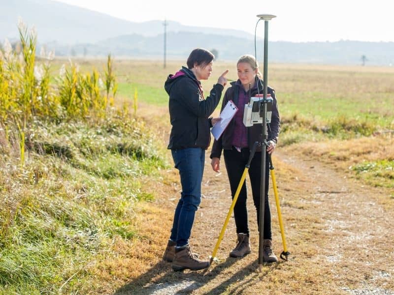
What Happens During the Survey?
A licensed surveyor comes to your property with GPS equipment and measuring tools. They collect elevation readings at points across the entire site. The more readings they take, the more detailed and accurate the final map will be.
Back at the office, those readings get turned into a topographic map usually showing contour lines at one-foot or two-foot intervals. Every engineer and architect who works on your project after that will rely on that map to do their job correctly.
What Does It Cost?
The cost depends on a few things: how big your property is, how complex the terrain is, and how much detail the project calls for. A small, flat residential lot costs less to survey than a large, hilly, wooded parcel.
The best approach is to call a licensed surveyor early, explain your project, and get a quote based on your actual property. One thing’s worth knowing: skipping the topo survey to save money almost always backfires. Redesign costs, construction change orders, and drainage repairs after the fact tend to cost far more than the survey would have.