
Boundary Survey Price for a Long, Wooded Parcel: What the Fieldwork Covers
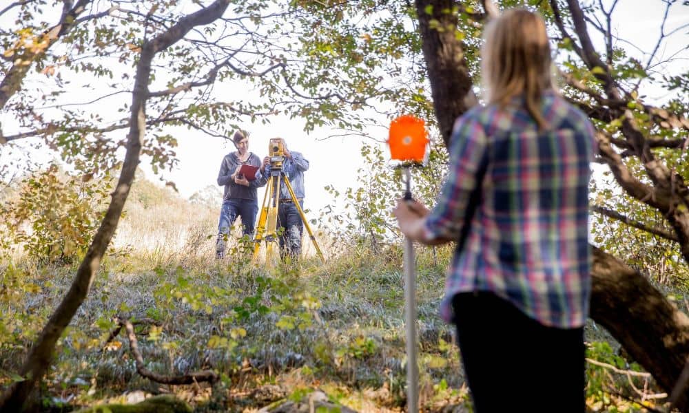
A long, wooded parcel can bring a boundary survey price that seems high for its acreage. The reason sits in the fieldwork. A crew has to measure every foot of the boundary, work around trees that block its view and search for corners that may be buried or gone.
This pattern shows up often around Nashville. Many rural tracts in the counties around the city run as narrow strips that climb a ridge or drop into a hollow. Cedar thickets and limestone ledges can sit right on the line a surveyor needs to follow.
Once you know where the crew spends its hours, a quote gets much easier to read. You can also compare two proposals with a better sense of what each one covers. The sections below explain the field conditions that shape the price on this kind of land.
Why Perimeter Length Can Matter More Than Acreage
A boundary survey works along the edges of a property. The crew measures the lines and checks the corners, so the total length of those lines shapes the job more than the land inside them. Two parcels with the same acreage can have very different amounts of boundary to cover.
Simple math shows the gap. A square 10-acre lot measures about 660 feet on each side, for roughly 2,640 feet of boundary. A 10-acre strip that’s 200 feet wide runs about 2,178 feet deep, which adds up to about 4,756 feet of line. That’s around 80 percent more boundary on the same amount of land.
Long parcels also tend to touch more neighbors. Each adjoining tract has its own deed and its own corners, and the surveyor may need to check those records to understand a shared line. A boundary that bends to follow an old fence or a creek adds angle points, and each one is another spot to measure.
How Heavy Woods Add Time Along the Boundary
Trees slow a survey because they block both the surveyor’s view and the satellite signal. Most boundary work relies on two kinds of equipment. A total station measures angles and distances to a reflector on a pole, and it needs a clear line of sight to do that. Satellite receivers, often called GNSS gear, read signals from GPS and other satellite systems and can lose accuracy under a thick canopy.
In an open field a crew can take long shots and move quickly. Dense woods force the crew to set up the instrument many more times, with short hops between trees. Surveyors call this chain of setups a traverse, and a long wooded line may need a lot of them.
Where a tree or thicket blocks a shot, crews usually cut a narrow sight path with hand tools. That path is typically just wide enough to see through. It’s a far cry from clearing the whole line. Steep slopes, rock outcrops and creek crossings also slow the walk between setups. Season plays a part too, since bare winter branches can open views that summer leaves close off.
Corner Recovery Can Become the Largest Fieldwork Variable
Corner recovery often decides how long the fieldwork takes. A surveyor needs evidence of where the corners are before trusting the lines between them. On wooded land, that evidence is harder to find than on a suburban lot.
Iron pins can sit under years of leaf litter and soil. Logging equipment can bend them or knock them loose. Older corners may be a pile of stones, a marked tree or the end of a fence row that has since fallen down. Crews often sweep with a metal detector and dig by hand to confirm what they find.
Search time is hard to predict before anyone walks the land. One corner might turn up in minutes, while another takes hours. A missing corner can send the surveyor looking for other evidence, such as nearby corners on a neighbor’s side or measurements from points already found. On a long tract, the next reliable corner may sit far down the line, so rebuilding a lost one can mean covering a lot of ground. That uncertainty is why many proposals state what they assume about corner conditions.
What a Boundary Survey Price Should Tell You About Scope
A boundary survey price should tell you what work the crew will do and what you’ll receive. A single number with no description makes it hard to tell whether two quotes cover the same job. Look for a proposal that spells out the details in plain terms.
Start with the corners. The proposal should say whether the surveyor will set new markers where corners are missing and what it assumes about finding the existing ones. It should also say whether the crew will place points along the lines between corners. On a long boundary, that one difference can change the price quite a bit.
Next, check the deliverable. Most boundary surveys come with a signed drawing, often called a plat, that shows the lines, corners and measurements. Ask whether the price covers flagging you can spot in the woods and whether any brush cutting beyond a sight path is part of the job. If a quote lists conditions that would add cost, such as extra corner searching, you can plan for them now.
Two quotes that look far apart may just cover different amounts of work. The lower number sometimes leaves out marking you expected to get. Put the proposals side by side and compare corners, line points and deliverables before you decide.
Details to Provide Before Requesting a Price
A surveyor can give a closer price when you share what you already have. Gather what you can before you call. Even partial information helps.
- Your deed and any recorded plat for the property. The surveyor will still do independent research, but these give a head start.
- Any older survey of the land. It can point to corners someone found before.
- The county parcel number or the address. This lets the surveyor pull up the tract and the neighbors around it.
- How to reach the back of the property. Mention gates, locks, rough roads or a neighbor you need to call first.
- Any corner markers, flagging or old fence lines you’ve seen. A rough note of where they sit can cut down search time.
- Why you need the survey. A timber sale, a new fence, a property sale or a building project can each call for different marking.
- Any deadline tied to the work. Share a closing date or a logging start date early.
Frequently Asked Questions
Does a survey crew clear trees and heavy brush for a boundary survey?
Don’t assume it will. Crews usually cut only what they need to see and measure, and larger clearing work varies from one property and one proposal to the next. Ask the surveyor to state in writing how much cutting the price covers.
Does a wooded parcel automatically need a topographic survey?
No. Trees on the land don’t create a need for topographic work by themselves. A topographic survey maps ground elevations and terrain for things like drainage, site design or planning a building, and surveyors price it as its own scope.
Is an ALTA survey priced the same way as a boundary survey?
No. An ALTA/NSPS Land Title Survey follows a national standard written for commercial real estate deals, and it usually covers more items than a standard boundary survey. A boundary quote and an ALTA quote describe different jobs, so one can’t stand in for the other.